Page layout, render style and overlays no longer need to be chosen blindly, example images are now shown on the side to help chosing the right option.
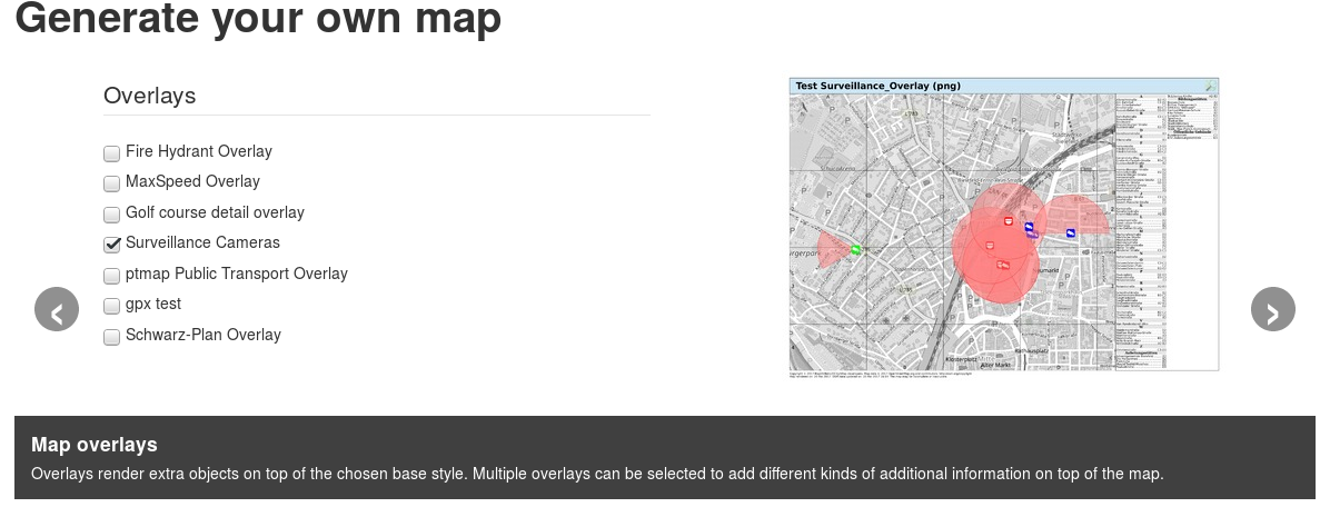
Continue reading “UI improvements: style and layout previews”
A playground for OSM related stuff
Page layout, render style and overlays no longer need to be chosen blindly, example images are now shown on the side to help chosing the right option.
Continue reading “UI improvements: style and layout previews”
The “New map” wizard form has now been fixed to not submit the form early on pressing [ENTER] in the “City search” field.
This used to produce form validation errors that were both annoying and hard to understand at that stage of the form.
Form submission is now only possible with the “Generate” button on the last wizzard page.
TL;DR: there have been some database and rendering daemon hickups over the weekend which should now be resolved. Main database is up to date again, “Waymarked Trails” route overlay database is still catching up …
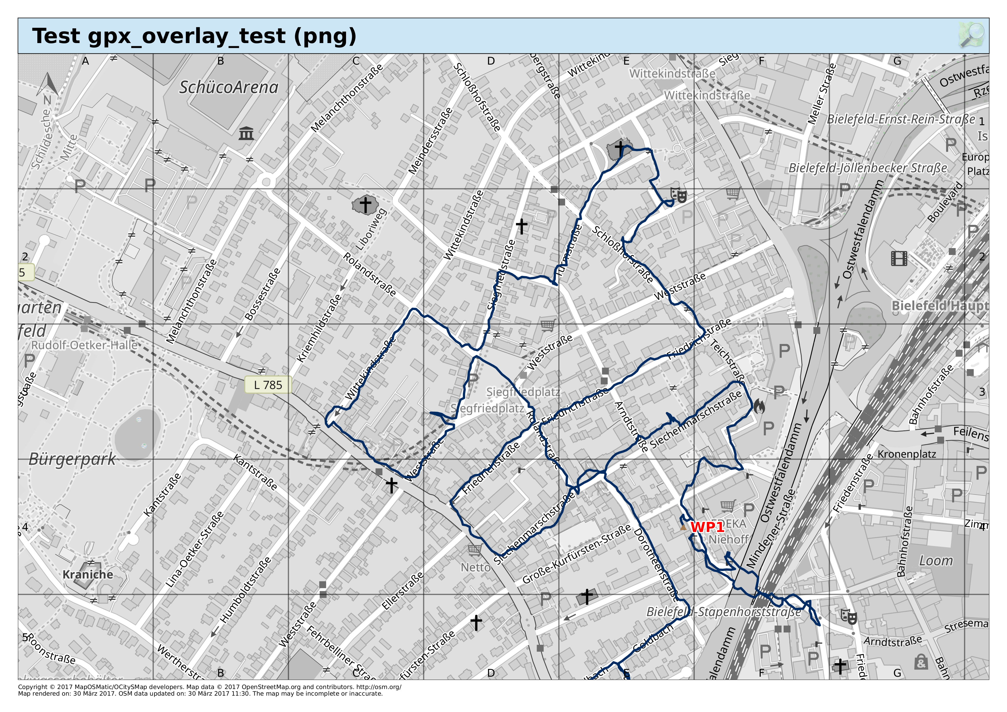
I’m planning to add a “bring your own GPX track” feature that allows to upload a GPX track to put on any given map as an overlay, including automatic bounding box detection.
This could e.g. be used to produce custom hiking maps from tracks downloaded from WayMarkedTrails.
The image below shows a first attempt, showing a track with a single way point (and obviously without bounding box detection yet).
As part of the testing process I now generate samples of all base and overlay styles for a predefined area, measuring the time it takes to render (with all three result formats linked) and creating a list of thumbnail PNGs on an overview page, linking to the actual full size PNGs.
Next step: integrate the thumbnails into the style selection part of the “new map” form in some clever way …
A small addition to the Fire Hydrant Overlay: defibrillators.
WayMarkedTrails overlays for hiking routes etc. are currently not available as the underlying database needs to be reimportet.