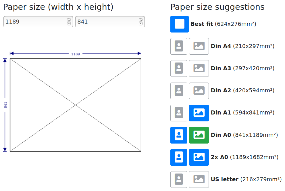
There will be some upcoming changes to the paper size form step during the weekend, hopefully making the paper size selection a bit more intuitive.
This is roughly how it will look like:
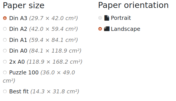
Compared to the current radio button based solution:
A playground for OSM related stuff
There will be some upcoming changes to the paper size form step during the weekend, hopefully making the paper size selection a bit more intuitive.
This is roughly how it will look like:
Compared to the current radio button based solution:
Do you remember my earlier post on data area bounds ?
Turns out I was a bit too naive on believing that the largest administrative bounds polygon in an extract always equals what the extract is actually supposed to be containing.
This assumption can be false for many different reasons:
This sometimes lead to a wrong admin polygon being shown as assumed data bounds, often one that only represents a small subset of the actual data.
So the bounds logic has now been changed to only assume that the largest contained admin polygons bounding box width and height are both witin 75% and 110% of the total data bounding box width and height. Otherwise the bounds shown on the slippy maps will just be that of the full data bounding box.
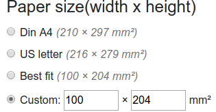
It is now possible to enter a custom paper width and height, so that map prints are no longer limited to the predefined paper sizes.
This can especially be useful when creating maps for different materials like textiles, customized jigsaw puzzles, etc. where the form factor does not match regular paper sizes.
As the headline says: this service has just received and processed its hundred thousands map render request.
I’m not really sure what’s going wrong with it, but apparently the paper layout is sometimes automatically switching to multi page format on submission of single page render requests, and the choice is made “sticky”, too, so the next time you create a map from the same browser multi-page layout is pre-selected.
I’ve experienced that a few times myself now, even with witnesses looking over my shoulder when it happened, but I have no idea by what this may be triggered yet.
Unfortunately I don’t have the time to debug this either right now, but I hopefully will get this tracked down by the end of the week.
Meanwhile, if you are interested, you may subscribe to the related github issue report:
Unfortunately my good old DesignJet printer acted up again on 36c3, being in on-and-off mode during most of day one, and breaking down totally on day two after just a few prints in the morning. Maybe it took the “Resource Exhaustion” congress motto too literal?
Anyway, the printer is some six years old by now, and was a discontinued model by the time I bought it already. So while I may be able to get it back to life once more by replacing another print head (with an originial this time, as with the refurbished once I tried there seems to be a one in four chance of immediate failure ….), I’m not going to move it around anymore.
So I’m currently thinking about a new Din A1 / 24″ roll printer for printing maps on events. The wishlist features would include:
Right now I think that of the current Din A1 models, the Epson SC-T3100N comes closes, but I’d very much be interested in hearing from anyone having first hand experience with it or with one of the alternative models.
What I know about it by now is:
The price point for this setup would be somewhat like:
When also adding a small laptop to the mix, a full “ready to use” conference package should be doable for under 2000€ … a bit too much for myself to cover privately, but there seem to be options to get that solved …
For some unknown reasons Mapnik has a problem with the color name DarkSlateGray, if this name occurs in a GeoJson color or fillColor attribute rendering will just fail with an exception.
Searching over the error logs I found that it is always just this one color name that makes rendering fail, but as I’m not sure about this being the only color name with a problem, I’ve now changed the Umap Json preprocessing code to do color name lookups on the python side already and replace them with their respective hex color code, so that Mapnik will never have to resolve color names by itself when processing GeoJson data files.
Depending on how an UMAP map was created some default attribute settings like colors and shapes were ignored, and the default global fallbacks were used, leading to all-blue results.
This should be solved now, my umap format parser should now be able to handle all variants of the umap json export format, so that correct colors, line widths and icon shapes should be shown in the rendered maps.
On Saturday next week (Nov 30 2019) I’ll upgrade this servers operating system. So the print map services will not be available for parts of that day, and maybe also for parts of Sunday Dec 1st