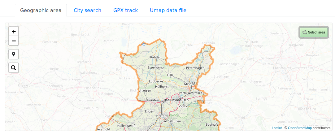
Local installations can now be bound to the actually imported data area.

When running a MapOSMatic instance that only has a regional OSM extract imported, and not the full planet data, map creation can now be restricted to the covered area only.
Map scrolling will be bound to the data bounding box, when trying to scroll beyond the bounds area the leaflet slippy map will bounce back to the allowed area.
Map areas around the imported polygon bounds will be grayed out to provide even better visual feedback, and city search will be restricted to citys and places within the bounding box of the imported data.
Hello, add the ability to create printed atlases with z18 zoom OpenStreetMap to display house numbers. Please consider this, your service is the best that I have seen for printing cards. But the lack of house numbers makes the printed Atlas useless for finding a particular house.